Evidence #224 | August 13, 2021
Shazer to Nahom
Post contributed by
Scripture Central
Abstract
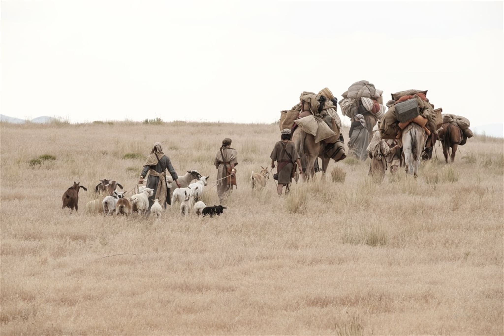
In various ways, Lehi’s journey from Shazer to Nahom is consistent with the known geography of western Arabia, as well as the ancient Frankincense Trail that ran through this region.A Long Journey
Based on correlations between Nephi’s account and the known geography of the Arabian Peninsula, it appears that Lehi’s journey from Shazer to Nahom represents the longest leg of his family’s travels through the wilderness (1 Nephi 16). They most likely began the journey at Wadi Agharr (or esh Sharma), the best candidate for Shazer (1 Nephi 16:13),1 located on the northwestern coast of Saudi Arabia. And the journey probably concluded near the Nihm tribal area in Yemen, the most likely location of Nahom (1 Nephi 16:34).2 This means a travel distance greater than 1000 miles is narrated in just about 20 verses. Despite its brevity, however, several details mentioned in Nephi’s account are consistent with a real-world setting.
South-Southeast Travel
When they departed from Shazer, Nephi said they were “following the same direction” they had gone previously (1 Nephi 16:14), which was “nearly a south-southeast direction” (1 Nephi 16:13). In early Islamic times, a pilgrimage route connecting Aelana (at the northern point of the Gulf of Aqaba) to the main Frankincense Trail near al-Hajir passed directly through Wadi Agharr in a generally south-southeast direction.3 Several of the halts along this trail are also identifiable in pre-Islamic sources, indicating that this road was being used for trade at earlier times.4 This helps confirm that Lehi and his family could have both arrived and departed from Wadi Agharr going in a generally south-southeast direction.5
“Borders by the Red Sea”
When they initially departed from Shazer, they were traveling “in the borders near the Red Sea” (1 Nephi 16:14). This is the last mention of the Red Sea in Nephi’s account, suggesting that soon after this point their direction of travel somewhat distanced them from the seacoast. These details are subtly consistent with the geography of the Hijaz mountains, south-southeast of Wadi Agharr.
The “borders” Nephi traveled through probably refer to the coastal hills and mountainous zone found near the Red Sea coast.6 The ancient route from Wadi Agharr to al-Hajir started near the coast, but gradually moved further inland through the Hijaz mountains as one traveled south.7 Thus, this route would have led Lehi’s party through the “borders of the Red Sea” but would also have steered them inland while maintaining a generally south-southeast course, just as Nephi’s account implies.
“Most/More Fertile Parts”
Nephi also said that they were, at first, “keeping in the most fertile parts,” and then afterward they went through “the more fertile parts” (1 Nephi 16:14, 16, emphasis added). In these fertile areas, they were “slaying food by the way” (v.15), but after passing the “more fertile parts” they had to stop to “obtain food” (v. 17). As George Potter and Richard Wellington observed, “Nephi’s description of the trail depicts declining fertility.”8
This interpretation of the text is consistent with what a traveler would experience going southward along the Frankincense Trail. The greatest amount of fertility would be seen while traveling between Hajir and Medina (ancient Yathrib). There is less fertility south of Medina, until eventually, south of Bishah, the region is virtually barren until reaching Najran and the Wadi Jawf further south in Yemen.9
Broken Bow Camp
On one occasion, when Lehi’s family stopped to hunt, Nephi’s bow “made of fine steel” broke, and his brother’s bows had “lost their springs” (1 Nephi 16:18, 21). Nephi’s bow was most likely a composite bow, reinforced or decorated with metal fittings.10 Such bows, according to an expert in ancient warfare, “have a specific structural problem that leaves them susceptible to changes in temperature and climate, which may cause the bow to warp and break.”11
Thus, going from an elevated and comparatively mild climate near Jerusalem to the muggy environs near the Red Sea and then to the dry, arid desert of Arabia—all combined with the regular and repeated use while hunting along the trail—would have slowly warped Nephi’s bow until it broke. It is also plausible that the changing environment could have contributed to the weakening elasticity of his brothers’ bows, “to the point that the bows had insufficient range and penetrating power for effective hunting.”12
To remedy the problem, Nephi “did make out of wood a bow, and out a straight stick, an arrow” (1 Nephi 16:23). The length and weight of the arrows Nephi used with his steel bow probably did not work with his newly fashioned wooden bow, thus necessitating that he also make a new arrow.13 Researchers found that in southern Saudi Arabia, wood suitable for making bows and arrows only grows in a limited area in the mountains southwest of Bishah, an area that fits well with Nephi’s account.14
Conclusion
While Nephi’s report of their journey over this stretch is concise, all verifiable details are consistent with the known geography along the western edge of the Arabian Peninsula. Their direction of travel is consistent with a known route used in historical times. It passes through the mountainous “borders” along the Red Sea shore then moves inland, merging with the main branch of the Frankincense Trail while generally maintaining “the same direction” (nearly south-southeast) the entire time.
Along the Frankincense Trail, Lehi’s family would have initially encountered frequent oases and areas of cultivation, but after passing Medina these would have become less frequent until they were in a predominantly barren region. This declining fertility along the trail is subtly but accurately reflected in Nephi’s account.
By the time they reached the more arid, barren region of southern Saudi Arabia, the wear and tear on their hunting bows, combined with the changing climatic factors, could have believably diminished the effectiveness of their bows and made Nephi’s bow more susceptible to breaking. Right in this same region, however, suitable wood can be found at the higher elevations in the mountains, making it possible for Nephi to construct a new bow.
Each of these details, alone, is perhaps minor and seemingly unimportant. Combined, however, they provide an overall picture that is impressive in its real-world accuracy, supporting the claim that Nephi’s account is an authentic historical record.
S. Kent Brown, “New Light from Arabia on Lehi’s Trail,” in Echoes and Evidences of the Book of Mormon, ed. Donald W. Parry, Daniel C. Peterson, and John W. Welch (Provo, UT: FARMS, 2002), 55–125.
George Potter and Richard Wellington, Lehi in the Wilderness: 81 New, Documented Evidences That the Book of Mormon is a True History (Springville, UT: Cedar Fort, 2003), 73–106.
Richard Wellington and George Potter, “Lehi’s Trail: From the Valley of Lemuel to Nephi’s Harbor,” Journal of Book of Mormon Studies 15, no. 2 (2006): 26–43, 113–116.
- 1 See Evidence Central, “Book of Mormon Evidence: Shazer,” December 18, 2020, online at evidencecentral.org
- 2 See Evidence Central, “Book of Mormon Evidence: Nahom,” March 9, 2021, online at evidencecentral.org.
- 3 See Abdullah al-Wohaibi, “The Northern Hijaz in the Writings of the Arab Geographers, 800–1150” (Phd diss.; University of London, 1969), 36, 377–391.
- 4 Nigel Groom, Frankincense and Myrrh: A Study of the Arabian Frankincense Trade (New York, NY: Longman, 1981), 206, 260n47.
- 5 See George Potter and Richard Wellington, Lehi in the Wilderness: 81 New, Documented Evidences That the Book of Mormon is a True History (Springville, UT: Cedar Fort, 2003), 83–92.
- 6 S. Kent Brown, “New Light from Arabia on Lehi’s Trail,” in Echoes and Evidences of the Book of Mormon, ed. Donald W. Parry, Daniel C. Peterson, and John W. Welch (Provo, UT: FARMS, 2002), 77–79. See also Potter and Wellington, Lehi in the Wilderness, 78–83.
- 7 See maps of the route in Groom, Frankincense and Myrrh, 192 and al-Wohaibi, “Northern Hijaz,” unpaginated map after p. 544. See also Potter and Wellington, Lehi in the Wilderness, 84.
- 8 Richard Wellington and George Potter, “Lehi’s Trail: From the Valley of Lemuel to Nephi’s Harbor,” Journal of Book of Mormon Studies 15, no. 2 (2006): 31.
- 9 See the map plotting points of fertility in Wellington and Potter, “Lehi’s Trail,” 31; Potter and Wellington, Lehi in the Wilderness, 81.
- 10 See Evidence Central, “Book of Mormon Evidence: Nephi’s Steel Bow,” January 4, 2021, online at evidencecentral.org.
- 11 William J. Hamblin, “The Bow and Arrow in the Book of Mormon,” in Warfare in the Book of Mormon, ed. Stephen D. Ricks and William J. Hamblin, (Salt Lake City, UT: Deseret Book and FARMS, 1990), 374.
- 12 Hamblin, “Bow and Arrow,” 375.
- 13 Hamblin, “Bow and Arrow,” 392–393.
- 14 Potter and Wellington, Lehi in the Wilderness, 95–106.
© 2024 Scripture Central: A Non-Profit Organization. All rights reserved. Registered 501(c)(3). EIN: 20-5294264